
The Ultimate Earthwork Takeoff Software for Civil and Site Work Estimating

Earthwork estimating can make or break a civil construction bid.
If your cut and fill quantities are wrong, everything downstream becomes risky: labor, equipment, trucking, materials, schedules, margins, and project profitability. A small mistake in the takeoff can become a very expensive problem once work starts on site.
That is why earthwork takeoff software has become so important for civil contractors, estimators, excavation companies, grading contractors, sitework teams, and heavy construction firms.
Instead of relying only on manual measurements, spreadsheets, paper plans, or rough assumptions, earthwork takeoff software helps teams calculate excavation, embankment, grading, utility trenching, surface areas, lengths, and material quantities from digital plans, CAD files, PDFs, survey data, drone data, or 3D models.
The right software helps estimators move faster, bid more confidently, compare plan revisions, reduce quantity errors, and create clearer documentation for internal teams, clients, and field crews.
AI is also starting to influence construction estimating workflows. Teams can use AI to review bid documents, summarize scope notes, flag missing information, organize assumptions, create proposal language, and speed up communication between estimating, project management, and operations.
Earthwork takeoff software is not just about measuring dirt. It is about creating a better estimating workflow from plan review to final bid.
Accurate earthwork estimating is one of the most critical and high-risk components of civil and site construction projects. A small miscalculation in cut and fill quantities, haul distances, or material volumes can quickly turn a profitable job into a loss. As project sizes grow and timelines tighten, traditional manual methods struggle to keep up. This is where modern earthwork takeoff software has become essential for contractors, estimators, and preconstruction teams.
In this guide, we will explore how advanced digital tools are transforming earthwork estimating, why accuracy matters more than ever, and what to look for when selecting the right solution for your workflow.
Chapters
- Why Earthwork Takeoffs Are So Challenging
- What Is Earthwork Takeoff Software?
- Key Benefits of Using Earthwork Takeoff Software
- Core Features to Look for in Earthwork Takeoff Software
- How Earthwork Takeoff Software Improves Civil Estimating Accuracy
- Earthwork Quantity Takeoff in Large-Scale Projects
- Reducing Risk and Rework With Digital Takeoffs
- Why Earthwork Takeoff Software Matters for Civil Sitework Bids
- Earthwork Takeoff Software for Excavation Contractors
- Earthwork Takeoff Software for Grading Contractors
- Earthwork Takeoff Software for Utility and Trenching Estimates
- How Earthwork Takeoff Software Improves Estimating Accuracy
- How AI Can Support Earthwork Estimating Workflows
- Earthwork Takeoff Software and Construction Marketing
- How to Compare Earthwork Takeoff Software
- Common Earthwork Takeoff Mistakes to Avoid
- Earthwork Takeoff Software for Better Project Handoffs
- Signs Your Company Needs Better Earthwork Takeoff Software
- The Future of Earthwork Estimating
- Choosing the Right Earthwork Takeoff Software for Your Team
- Final Thoughts
Why Earthwork Takeoffs Are So Challenging
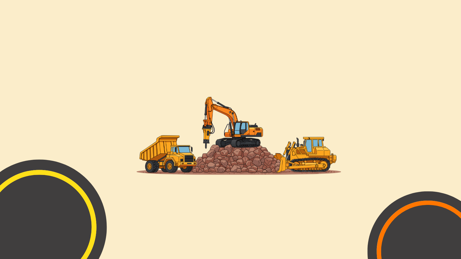
Earthwork estimating is fundamentally different from vertical construction takeoffs. Instead of counting discrete elements, estimators must analyze complex surfaces, elevations, slopes, and subsurface conditions. Civil projects often include:
- Large, irregular site boundaries
- Multiple grading revisions
- Cut and fill balancing requirements
- Variable soil conditions
- Excavation stability considerations that may require engineered ground anchors or retention systems
- Long haul routes and disposal considerations
Manual approaches using paper plans or basic CAD measurements are time-consuming and highly prone to error. Even spreadsheet-based workflows often fail to capture the dynamic nature of earthwork changes. This is why digital transformation in this area is no longer optional.
What Is Earthwork Takeoff Software?
Earthwork takeoff software is a specialized estimating tool designed to calculate excavation, embankment, grading, and material volumes directly from digital plans or models. Instead of relying on hand measurements, estimators can generate precise quantities by analyzing surfaces, contours, and elevations in a fraction of the time.
At its core, the software automates earthwork quantity takeoff by interpreting site geometry and converting it into measurable data that supports accurate cost forecasting and bidding decisions.
Key Benefits of Using Earthwork Takeoff Software
1. Significant Time Savings
Traditional earthwork takeoffs can take days, especially for large civil projects with multiple plan sets. Digital takeoff tools reduce this to hours or even minutes by automating measurements and calculations.
2. Improved Accuracy and Consistency
Automated calculations eliminate common human errors such as missed areas, incorrect slope assumptions, or double-counting volumes. This consistency is especially valuable when multiple estimators collaborate across projects.
3. Faster Bid Turnaround
With bidding windows shrinking, speed is a competitive advantage. Faster takeoffs allow teams to pursue more opportunities without increasing staff workload.
4. Better Change Management
Revisions are inevitable in civil projects. Modern software allows estimators to quickly re-run quantities when plans change, avoiding the need to start from scratch.
5. Data-Driven Decision Making
Accurate earthwork data supports smarter decisions around equipment selection, hauling strategies, sequencing, and risk assessment.
Core Features to Look for in Earthwork Takeoff Software

Not all solutions are built the same. When evaluating tools, civil contractors should focus on features that directly impact productivity and accuracy.
Digital Plan Compatibility
The software should support common file formats such as PDF, DWG, and BIM-based models, allowing seamless import of site drawings and surfaces.
Surface and Volume Calculations
Advanced tools can analyze existing and proposed surfaces to automatically calculate cut, fill, and net volumes.
Flexible Measurement Tools
Look for the ability to handle irregular boundaries, complex slopes, and multi-phase grading areas.
Revision Tracking
The ability to compare versions and understand how changes affect quantities is critical for managing risk.
Integration With Estimating Workflows
Earthwork quantities should export easily into estimating systems, spreadsheets, or bid management tools to maintain a smooth preconstruction process.
How Earthwork Takeoff Software Improves Civil Estimating Accuracy
Accuracy in earthwork estimating directly impacts labor planning, equipment utilization, fuel costs, and material sourcing. By using dedicated earthwork takeoff software, estimators can:
- Balance cut and fill more efficiently to reduce import/export costs
- Identify over-excavation risks early
- Optimize haul distances and logistics
- Reduce contingency padding driven by uncertainty
This level of precision enables contractors to submit more competitive bids without increasing financial exposure.
Earthwork Quantity Takeoff in Large-Scale Projects
On large infrastructure and site development projects, manual methods simply do not scale. High-resolution digital takeoffs allow teams to break projects into logical zones, phases, or scopes, ensuring that quantities align with construction sequencing.
Modern earthwork quantity takeoff workflows also support collaboration between estimators, project managers, and engineers, ensuring everyone is working from a single source of truth.
Reducing Risk and Rework With Digital Takeoffs
One of the biggest hidden costs in earthwork is rework caused by inaccurate assumptions during bidding. Overestimating volumes can price a contractor out of contention, while underestimating can lead to cost overruns and strained margins.
By relying on data-driven takeoffs instead of intuition-based estimates, contractors reduce exposure to these risks and gain greater confidence in their bids.
Why Earthwork Takeoff Software Matters for Civil Sitework Bids
Civil sitework bids are highly quantity-driven.
If the takeoff is off, the estimate is off. That can lead to underbidding, lost profit, disputes, delays, or missed opportunities.
Earthwork takeoff software helps contractors improve:
Bid speed
Estimators can complete quantity takeoffs faster than manual methods.
Bid accuracy
Digital measurements help reduce missed areas, duplicate measurements, and calculation errors.
Plan revision control
Estimators can compare changes when updated drawings are issued.
Scope clarity
Clear takeoff reports make it easier to explain assumptions and quantities.
Team communication
Estimating, project management, and field teams can work from clearer quantity data.
Risk management
Better quantities help reduce surprises related to hauling, importing, exporting, and material movement.
Competitive bidding
Faster workflows can help contractors bid more jobs without sacrificing quality.
In earthwork estimating, speed matters. But speed without accuracy is dangerous. The best software helps teams move faster while keeping calculations transparent and reviewable.
Earthwork Takeoff Software for Excavation Contractors
Excavation contractors need fast, accurate quantities because the work is heavily tied to equipment, hauling, labor, fuel, and production rates.
Earthwork takeoff software can help excavation teams estimate:
- Mass excavation
- Basement excavation
- Site stripping
- Topsoil removal
- Rock excavation
- Borrow material
- Spoil export
- Fill import
- Compaction quantities
- Stockpile volumes
- Haul distances
- Utility trench excavation
- Backfill quantities
For excavation contractors, the software should make it easy to understand how much material must be moved, where it is coming from, where it is going, and what it means for cost.
A better takeoff helps answer questions such as:
- How much cut is on the site?
- How much fill is needed?
- Is the site balanced?
- Will material need to be imported or exported?
- How much trucking is required?
- Which areas carry the highest quantity risk?
- What changed in the revised plans?
These answers help estimators price the job more confidently and help operations plan the work more realistically.
Earthwork Takeoff Software for Grading Contractors
Grading contractors need clear surface data.
A grading estimate is not only about total volume. It is also about shape, slopes, elevations, access, sequence, and production.
Earthwork takeoff software can help grading teams estimate:
- Rough grading
- Fine grading
- Pad preparation
- Roadway grading
- Parking lot grading
- Slope work
- Drainage features
- Swales
- Berms
- Building pads
- Subgrade preparation
- Aggregate base
A strong grading takeoff should help the estimator understand where the work happens, not only how much work exists.
Visual takeoff tools can make it easier to review high-risk areas, identify steep changes, and spot possible plan conflicts before the bid is submitted.
Earthwork Takeoff Software for Utility and Trenching Estimates
Utility work can be complex because trench quantities depend on depth, width, bedding, backfill, pipe length, structures, and site conditions.
Earthwork takeoff software can help estimate:
- Storm drainage trenches
- Sanitary sewer trenches
- Waterline trenches
- Electrical duct banks
- Communication trenches
- Pipe bedding
- Backfill
- Manholes
- Catch basins
- Inlets
- Trench spoil
- Pavement restoration
A good trenching estimate needs more than a line length. It needs depth, trench profile, material assumptions, bedding requirements, and restoration quantities.
Software can help standardize these calculations so estimators do not rebuild the same formulas for every project.
How Earthwork Takeoff Software Improves Estimating Accuracy
Accurate estimating starts with accurate quantities.
Earthwork takeoff software helps improve accuracy by making measurements more visible, repeatable, and easier to check.
It can help reduce:
- Missed plan areas
- Duplicate measurements
- Wrong scale settings
- Spreadsheet formula errors
- Manual volume assumptions
- Misread elevations
- Forgotten scope items
- Confusion between drawing revisions
- Inconsistent measurement methods
The software also helps estimators document assumptions.
That matters because many civil bids depend on assumptions about soil conditions, shrink and swell factors, haul routes, import and export needs, compaction, and production rates.
When assumptions are documented clearly, teams can review the estimate more effectively and avoid confusion after award.
How AI Can Support Earthwork Estimating Workflows
AI is not replacing experienced civil estimators.
But it can help reduce manual work around the estimating process.
AI can support earthwork and civil sitework estimating by helping teams:
- Summarize bid documents
- Extract scope notes
- Draft bid clarifications
- Organize addenda
- Compare specification language
- Create proposal text
- Summarize subcontractor quotes
- Draft RFIs
- Create checklist items
- Turn takeoff notes into estimate summaries
- Review repeated assumptions
- Prepare internal handoff notes
For example, an estimator can use AI to summarize a long project specification and highlight sections related to excavation, dewatering, erosion control, unsuitable soils, compaction, testing, or site access.
AI can also help marketing and business development teams create project case studies, proposal introductions, capability statements, and bid-support content from completed project notes.
The strongest workflow combines specialized takeoff software with AI-supported document review, communication, and reporting.
Earthwork Takeoff Software and Construction Marketing
Construction companies can also use estimating workflows to improve marketing and sales content.
Many civil contractors already have valuable proof hidden in project files, takeoff notes, site photos, project reports, and completed bid stories. AI can help turn that information into useful content for future customers.
Examples include:
- Project case studies
- Before-and-after sitework stories
- Service pages for excavation or grading
- Bid proposal summaries
- LinkedIn project updates
- Website content for civil services
- Capability statements
- Email outreach for developers and general contractors
- Landing pages for regional services
- FAQ content based on customer questions
For example, a contractor that regularly completes commercial sitework can use project data to create content around:
- Commercial site preparation
- Earthwork estimating
- Mass excavation
- Parking lot grading
- Utility trenching
- Stormwater installation
- GPS machine control
- Civil site development
This helps potential customers understand what the company does and why its estimating process is reliable.
How to Compare Earthwork Takeoff Software
When comparing earthwork takeoff software, focus on workflow fit.
A tool may look powerful in a demo but still be wrong for your team if it is too complex, too limited, or difficult to connect with your estimating process.
Compare tools based on:
Ease of use
Can your estimators learn it without slowing down every bid?
Earthwork-specific features
Does it support cut and fill, contours, surfaces, and site balancing?
Input formats
Can it handle PDFs, CAD files, drone data, or survey files?
Reporting quality
Are quantity reports clear enough to review and share?
Revision management
Can you compare plan changes easily?
Estimating integration
Can quantities flow into your estimating system or spreadsheets?
Collaboration
Can multiple people review or update the takeoff?
Support and training
Does the vendor understand civil construction workflows?
Machine control support
Can the software help create or support field-ready models?
Cost
Does the pricing match your bid volume and project complexity?
The best tool is the one your team will actually use consistently.
Common Earthwork Takeoff Mistakes to Avoid
Even with good software, mistakes can still happen.
Avoid these common issues:
Using the wrong plan scale
A wrong scale can ruin the entire takeoff.
Forgetting drawing revisions
Always check the latest plan set, addenda, and revision dates.
Ignoring shrink and swell factors
Soil behavior can affect hauling, import, export, and compaction assumptions.
Missing utility trench quantities
Utility excavation and backfill can add significant cost.
Overlooking stripping and topsoil
These quantities should be separated from mass excavation when needed.
Not checking existing and proposed surfaces
Surface errors can create major volume problems.
Relying only on automatic results
Software outputs should be reviewed by an experienced estimator.
Not documenting assumptions
Unclear assumptions can lead to disputes or poor handoffs.
Skipping internal review
A second set of eyes can catch missed scope, wrong elevations, or unusual quantities.
A strong estimating process uses software, experience, review, and documentation together.
Earthwork Takeoff Software for Better Project Handoffs
A good estimate should not disappear after the bid is won.
Earthwork takeoff software can help create better handoffs from estimating to operations.
Useful handoff information includes:
- Quantity summaries
- Cut and fill maps
- Import and export assumptions
- Hauling assumptions
- Utility trench quantities
- Material quantities
- Scope inclusions
- Scope exclusions
- Risk notes
- Production assumptions
- Plan revision notes
- Clarifications
- Subcontractor quote notes
When the project team understands how the estimate was built, they can plan the work more effectively.
This helps reduce the gap between bidding and field execution.
Signs Your Company Needs Better Earthwork Takeoff Software
Your current estimating workflow may be holding your team back if you notice these issues:
- Takeoffs take too long
- Estimators rely too heavily on manual spreadsheets
- Quantity reviews are difficult
- Plan revisions cause confusion
- Bids are inconsistent across estimators
- Earthwork quantities are hard to explain
- Too many missed scope items show up after award
- You cannot bid enough projects
- Handoffs to operations are unclear
- Your team struggles with CAD, PDF, or drone data
- You lack clear documentation for cut and fill assumptions
Better software will not fix every estimating problem, but it can give your team a more reliable system for measuring, reviewing, and communicating quantities.
The Future of Earthwork Estimating
As artificial intelligence and machine learning continue to advance, earthwork takeoff software is becoming smarter and more predictive. Emerging capabilities include:
- Automated recognition of grading features
- Predictive cost modeling based on historical projects
- Real-time collaboration across distributed teams
- Integration with digital twins and construction planning tools
These innovations are reshaping how civil contractors approach preconstruction, shifting the focus from manual calculation to strategic analysis.
Choosing the Right Earthwork Takeoff Software for Your Team
Selecting the right solution depends on your project types, team size, and estimating complexity. The best tools are intuitive, scalable, and flexible enough to handle both small site jobs and large infrastructure projects.
Before committing, consider running pilot projects, reviewing support resources, and ensuring the platform aligns with your long-term digital strategy.
Final Thoughts
Earthwork estimating is no longer just about measuring dirt. It is about speed, accuracy, and strategic insight. Investing in the right earthwork takeoff software empowers civil and site contractors to bid smarter, reduce risk, and stay competitive in an increasingly demanding market.
With automated earthwork quantity takeoff, estimators gain the clarity and confidence needed to make informed decisions long before equipment hits the ground. In today’s construction landscape, that advantage can make all the difference.
Other Interesting Articles
- AI LinkedIn Post Generator
- Gardening YouTube Video Idea Examples
- AI Agents for Gardening Companies
- Top AI Art Styles
- Pest Control YouTube Video Idea Examples
- Automotive Social Media Content Ideas
- Plumber YouTube Video Idea Examples
- AI Agents for Pest Control Companies
- Electrician YouTube Video Idea Examples
- How Pest Control Companies Can Get More Leads
- AI Google Ads for Home Services
- 60-Second Training Videos Are the New Corporate Standard
- Cybersecurity PR Pricing: Retainers, Deliverables & ROI
- Best AI Tools for Product Consistency in E-Commerce Video
Master the Art of Video Marketing
AI-Powered Tools to Ideate, Optimize, and Amplify!
- Spark Creativity: Unleash the most effective video ideas, scripts, and engaging hooks with our AI Generators.
- Optimize Instantly: Elevate your YouTube presence by optimizing video Titles, Descriptions, and Tags in seconds.
- Amplify Your Reach: Effortlessly craft social media, email, and ad copy to maximize your video’s impact.